There we are, a full
PTL report, seasoned with a selection of live tweets by
Leo and
myself and pictures from Leo's camera. Tweets are formatted like this:
Julien | D-2 arrived in chamonix under the sun. nice view on the mont-blanc!
I hope you have time to read. The ascents are reported from the split time table and the split distances are taken from the most recent route description.
Before the race
In order to be more efficient at the drop bag points and on the move, we decided to pre-pack some mini-meals in resealable bags instead of taking bulk cheese, saucisson, and bread. We finished packing them in the hotel room, which could see up to 54 bags plus various bars lying around at some point... An external eye would probably have wondered what was going on. See the end of this article for more details.
Julien | H-27 packed 18 mini-meals: parmesan, saucisson, bread, nuts, snikers, chestnut spread
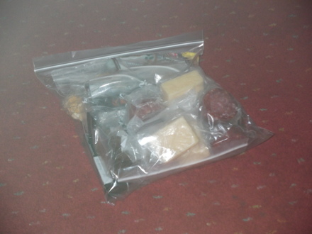
3 mini-meals = 1 full day
Whilst walking in Chamonix, we bumped into
Susan and Rob, two great American ultrarunners who I already met at the
inaugural Hardmoors 110 back in 2008. At the time, Rob had already run 530 ultramarathons... I'm not sure what's the count today, but I guess it must be over 600. They were both philosophical as I knew them, and Rob confirmed to me that life is a bit like an ultramarathon: you have to take it slowly to enjoy it and make the right decisions to be happy.
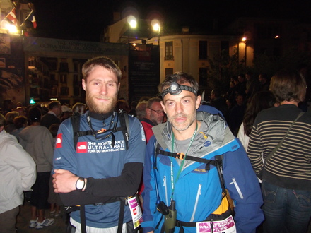
Julien | M-45 double espresso next to the starting line
Stage 1: Chamonix (France) - Rifugio Deffeyes (Italy)
Just as last year, the start was given on Tuesday at 22:00 on the Place du Triangle de l'Amitié in
Chamonix (1035m). Whereas the "official" UTMB soundtrack is
Vangelis - Conquest of Paradise, the PTL one's is
The Last of the Mohicans. Just as last year too, the supporters definitely outnumbered the runners (74 teams).
Ready to go!
The first kilometres were no news to all UTMB runners, with the relatively flat way to
Les Houches before the ascent to the
Col de Voza (1653m). In order to delay a bit the more technical sections, the organisers added the ascents to the
Chalets du Truc (1719m) and
Tré-la-Tête (1970m) before reaching
La Balme (1706m). It was really a pleasant start, with a beautiful full moon. A bit cold at times, though.
A few teams started to get a bit lost in the woods before La Balme. A recurrent issue all along the event!
The more serious business started with the
Col d'Enclave (2672m), a slightly technical ascent in a boulder field, that was tackled by daylight this time. The sun started to warm us up at the Col, where a runner decided it was the perfect time to light up a cigar :)
Generally speaking, I was surprised not to feel too bad overnight as I usually do.
Julien | Sunrise at col enclave after lovely night with full moon :) feeling generally good but a bit tired
Sunrise and breakfast at Col d'Enclave
We then went all the the way down to
Les Mottets (1870m) and up again for
Col de l'Ouillon (2612m). So far so good. We got into a general rhythm, with Leo leading most of the way up, whereas I would typically go down first.
Julien | 5th summit of the "day" and 2nd above 2600m. sunny and great views
I might repeat myself (see the
profile), but from there, we went down a long slightly downhill and boggy section before going up to the
Col de Forclaz (2525m). Surprisingly enough, we then went down to the
Col du Petit Saint-Bernard (2153m), where we entered Italy. This was also a checkpoint / rest area that was originally set up for the TDS, so we got a bit of free food and drinks and left relatively quickly in a hope to arrive early at the Refuge Deffeyes on the same night. We were the 25
th team to check in there. At that point I realised I had got a bit sunburned, but couldn't do much about it.
Leo | Reached petit st bernard moving straight on to refuge to sleep only 2800m summit in between!
The ascent to
Mont Valezan (2883m) was not difficult, and we were greeted at the summit by a great sunset on the Mont-Blanc chain. A strong cold wind dissuaded us to enjoy it for too long.
Julien | Mt valesan 2883m 7th and last high point of the day
Sunset at Mont Valezan.
From there, we went down a ridge that seemed endless, and then down a ski track that was anything but pleasant. But the worst was still to come. The navigation at the bottom of the Bella Comba valley was a real nightmare. Obviously, we were tired and eager to arrive and rest at the refuge, but this wouldn't be without fighting for it. First of all, the path was nearly non-existent at times. Secondly, the GPS was really struggling to acquire the satellites when we were in dense forests or nearby steep slopes. And because the reference track was obviously recorded by a GPS with similar shortcomings, the error could be doubled. As a result, it was not uncommon to progress apparently 30m away from the official route. Little by little, we learnt how to interpret the GPS readings, more as a relative motion rather than an absolute position. At each dodgy path junction, a few teams would gather and runners would scatter in all directions until someone had found what was assumed to be the correct route. On top of that, the route meandered so much that I got the impression we were going in circles. This section took us 2 hours longer than expected.
We finally arrived at the bottom of the dreaded final ascent to
Rifugio Deffeyes (2509m). I remember this ascent in the fog and in a forest last year. I was quite surprised to realise with this year's clear sky that there was no such forest! We finally arrived at 1am after 27 hours non-stop, lucky to get a hot meal and went straight to bed for 5 hours.
Split: 27:00 hours | 86.1km | +6,186m | -4,725m
Overall: 27:00 hours | 86.1km | +6,186m | -4,725m
Stage 2: Rifugio Deffeyes (Italy) - Saint-Oyen (Italy)
We left the refuge just before 7am, to follow the moraine leading to the
Pas de Panaval (3010m). This was actually the highest point we'd reach during the entire event, a fact unknown to us at the time, and due to the later alternative route around the Mont Rogneux.
Julien | Great sunrise at col planaval 3006m - yannick: 11 so far
Sunrise at Pas de Panaval.
Jean-Claude Marmier (event organiser) had attached a fixed rope for us to be safer on the relatively steep snow slope down the col. He actually had spent the night there to make sure we were not doing anything stupid... The way down to
Morgex (923m) was really long and hot at first, with a problematic lack of drinkable water on the way. Leo was so desperate to get some that he finally tried to extract a few sips from a half-stagnant filthy "spring", located 50cm away from cow dung...
We got a bit lost at some point, and were not helped by the "jokes" introduced by the organisers in the route description English translation. For example:
070T Path junction to R in the direction of the Pervod ruins (on no account go to the right as this would involve a long detour to reach Morgex).
Should we go to the right, then... or maybe not?
We finally reached Morgex, where we ate a welcome plate of lasagna for lunch and had access to our drop bags. I asked where to find a pharmacy (to buy sunscreen), but because it was too complicated/too far, Mimmo, the local organiser, offered me to give me a lift in his car, which I refused as I didn't want to use any other means of transportation, even if it was to go back to the same place eventually. It was hard to battle against an Italian. When he discovered I only wanted sunscreen, he then took his car to buy me some, and then refused my money in exchange! So a very big thank you Mimmo! It shows a lot of the volunteer's dedication on the route.
Julien | Leaving morgex after lasagna. so far so good
Leo | Top of col fetita moon rising feeling ok heading st oyen looks like tent
We then left for the
Col Fetita (2557m), where the night fell, then made our way to the
Col de Citrin (2484m), followed by the long way down to
Saint-Oyen (1365m). This is one of the slightly boring part of the PTL: there were a few long ways down on forest tracks / roads to reach villages, whereas I would prefer to stay a bit higher up.
Unfortunately, the partner hotel was not open that late in the night (1:30am as far as I remember), so we resolved to bivouac above the village. Leo's Terra Nova Laser Photon might be
the world's lightest tent (700g), but it's also quite "cosy" to sleep two... We couldn't move, and I couldn't even fully extend my legs, so I went out of the tent after an hour. After too few hours spent in a generally horizontal position, we decided to carry on.
Leo | Tucked up snug in the worlds lightest, and smallest 2 man tent up in 4 hours
Split: 18:30 hours | 50.6km | +3,050m | -4,160m
Overall: 51:30 hours | 136.7km | +9,236m | -8,885m
Stage 3: Saint-Oyen (Italy) - Bourg Saint-Pierre (Switzerland)
We got "awaken" by a text message from the UTMB organiser for all runners scheduled the same day on the UTMB, TDS and CCC. It was a warning that the weather was not looking good and therefore runners should be equipped correctly. We've heard later that masses of runners bought waterproof jackets at the last minute in Chamonix... We left at about 6am after little rest, for what was to be a short but intense day.
Leo | Not a good nights sleep off we go
We first started with the
Col de Barasson (2681m), where we entered Switzerland and where the clouds started to gather. We then had a welcomed early lunch at a restaurant at
Col du Grand Saint-Bernard (2469m). They were nice enough to serve us the meal of the day at 10am.
Bad weather gathering at Col de Barasson.
Julien | Early lunch at col grd st bernard. after the sun in italy, the wind and rain in switzerland...
We didn't realise at the time that we went to Saint-Bernard's "restaurant" instead of its "hospice", where a PTL checkpoint was manned and where we would probably have been advised to skip the Pointe de Drône and go straight down to Bourg Saint-Pierre due to the "inclement" weather. Indeed, it was raining quite hard when we started to ascent to the
Pointe de Drône (2949m) under the unbelieving eyes of the tourists arrived there by bus. It was only to get worse later, as the wind picked up when we were crossing a section equipped with ladders and chains. It was effectively a
via ferrata, as a cable was running along in case you felt the need to be better protected. The wind was particularly bothering, as it flew our ponchos in front of our faces, so we couldn't see were to move our hands and feet...
Via ferrata to Pointe de Drône under wind and rain - we didn't bother much longer with the camera.
We finally reached down the
Lacs de Fenêtre (2456m), after following down a hairy ridge. We then went up the
Pointe des Gros Six (2873m) under a very strong wind.
Leo | Col de neve de rouse something blowing a gale sunny drowned earlier
As we approached Bourg Saint-Pierre, we noticed a few teams around us, and started to wonder in the back of our minds where they could be coming from as we had been pretty much alone for the last 6 hours. The answer was given to us at
Bourg Saint-Pierre (1632m), 19:30. Teams stopping at the Grand Saint-Bernard hospice had been told to follow an alternative route directly down to Bourg Saint-Pierre, avoiding the bad weather at the Pointe de Drône and the Pointe des Gros Six! At that point, we also learnt about a further route modification ahead: we were to shortcut the way up to the Col de Lâne and the Mont Rogneux, as only the 2 first teams went through, and the third one renounced after judging the conditions "dantesque". That's also when we learnt that the UTMB was cancelled.
Leo | Just arrived bourg st Pierre route changes due to weather
Julien | Today was epic in bad weather on the ridge... We didn't know we could shortcut
We had a very good meal at Hotel du Crêt and proceeded to try to sleep. Because we were one of the last team which had gone through the Pointe de Drône, many teams had caught up with us via the alternative route, and the official checkpoint was really packed with runners. We were lucky enough to arrive just in time to secure a place in the dorm, but sleeping was not easy, as it was hot, humid, smelly, noisy and some lights went on and off. As I was trying to sleep, I overheard conversation between a runner and a volunteer:
Runner: But that's completely full!
Volunteer: Well, yes, some people are sleeping longer than expected...
R: There are 200 runners expected here and that's all you have?
V: I'm only a volunteer, I can't change anything about it.
R: But where am I going to sleep then?
V: Well, tent and sleeping bag I guess...
R: What tent and sleeping bag?
V: The ones you have.
R: What do you mean?
V: You must have a tent with you, don't you?
R: (ironic) Oh, really, so now we need to carry a tent?
V: Well, that's in the regulations...
R: What regulations?
V: It's in the compulsory gear list: you must carry a tent!
R: OK, let's not discuss the regulations now.
Julien: ZZZzzzz......
Split: 13:30 hours | 30.6km | +2,528m | -2,285m
Overall: 69:30 hours | 167.2km | +11,781m | -11,170m
Stage 4: Bourg Saint-Pierre (Switzerland) - Chamonix (France)
Leo and I eventually decided to leave once more before the alarm clock went off, on Saturday at about 1:30am, with a bit of hope to finish the same day.
Julien | Leaving bourg st pierre. just heard utmb cancelled because weather. What a shock!
We left under the rain with a few other teams, followed the advised alternative route directly to the
Cabane des Mille (2472m), where we stopped for a hot chocolate.
A posteriori, I think it would have been safe and possible to go through the Col de Lâne and the Mont Rogneux that night. The weather had calmed down, and we had a fair amount of time ahead of us.
At that point, I started to suffer a bit from the sleep deprivation, as for example my brain was sometimes not motion-compensating my vision. That means that I would see something similar to a hand-held video recorded by someone running. Also, instead of getting an adrenaline rush that would wake me up when I was tripping, I would at the opposite fall into some half-dreaming state for a fraction of second... Weird.
Leo | Cabine de Mille 0500 hot chocolate followed by descent to low point and oxygen
We then went all the way down to
Orcières (910m), the lowest point on route, where we bought some croissants for breakfast. If we had done the Mont Rogneux, we would have gone from the highest point to the lowest in one stretch.
Leo | In osiers plenty of oxygen at 800m pity we now have to climb to 2700m but lunch on the way
Easy ascent to
Champex-Lac (1466m), where we got an early lunch at the UTMB food station (relatively quiet at the time, as we arrived in between the CCC and the re-routed UTMB).
Julien | Lunch at Champex, 200km. getting ready for the final push. starts getting hard to carry on at times
We then headed towards the
Fenêtre d'Arpette (2665m) in the wind, rain, hail, and fog. It was freezing up there, with some ice crystals forming on our clothes. I'm really glad I took a proper Gore-Tex jacket, rather than a so-called waterproof running jacket.
Leo | At top of la fenetra d'arpette great name now look at your fridge that's the view look in it and that's what's coming down, ice

Wind, rain and fog at Fenêtre d'Arpette.
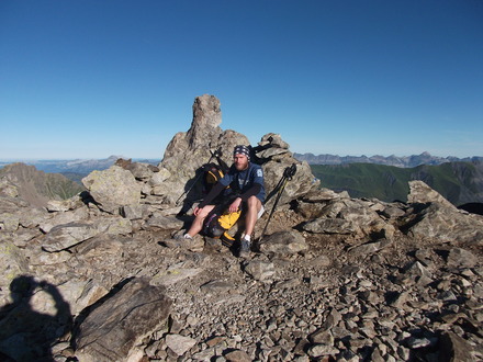
I was feeling quite good that day, and when we reached the
Chalets du Glacier (1583m), I couldn't resist to have a try at climbing a nearby boulder :)
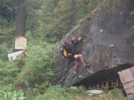
Spending a bit of spare energy after 212km.
A good surprise (to us) at the
Col de Balme (2202m): there was a refuge serving hot meals. We decided to get diner there before the last push to Chamonix. The refuge looked like it hadn't changed for the last 50 years, with a lot of hand-written signs telling you what you're not allowed to do and quite a few props you would buy at an antique fair. It seemed that most teams had decided to rest before leaving, so we only saw one team for the remaining 7 hours.
Leo | Col de la balm heading into the night hopefully to finish early sun am we'll see
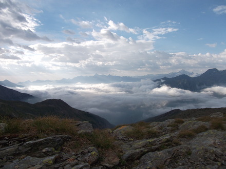
As we passed the border and entered France again, the fog started to dissipate and the view cleared up. I won't say that we had bad weather only in Switzerland... On the way down to
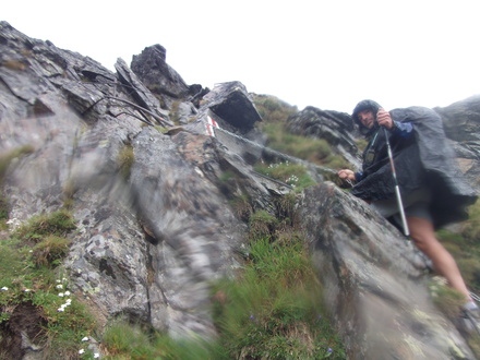
Tré-le-Champ (1417m), we were offered a stunning view of the Mont-Blanc by moonlight. Trying to stay awake on that section, we ended up talking non-sense for quite a while, sharing the (mild) hallucinations we had. We also calculated the probability of picking a slug with our walking poles. I just remember that the final result was 1/4000 per step. We then attacked the (fun) section up the ladders through the cliffs of the Chéserys. Leo reckoned it was probably a good think we did it by night, as we couldn't see how far down we could potentially fall...
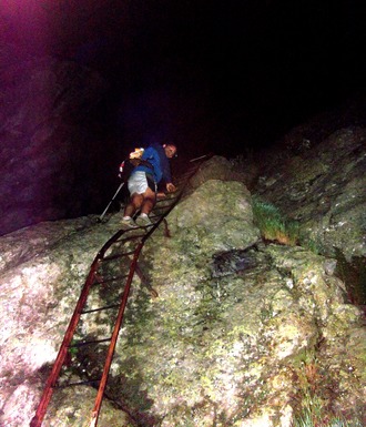
Up the ladders to La Tête aux Vents.
We were so tired and so used to walk with poles for the last 4 days, that when we arrived at the top of the ladders with the poles packed away in the bags, we could barely balanced ourselves on two legs only :)
Reaching
La Tête aux Vents (2130m), we were both in high spirits: we only had 10km downhill to go via
La Flégère (1860m), following the UTMB route, which was
obviously easier than the PTL. Well, it didn't quite go that way. First of all, we were constantly overtaken by the UTMB runners, and had to pull aside every time. Everything started to be painful. We then entered the forest and went down a relatively bad path (roots and stones) in a dense fog. It was a bit of a nightmare. But we eventually made it back to
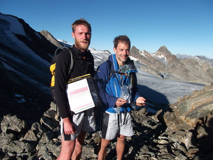
Chamonix (1035m) at 3:30am, to collect our finisher jacket!
Leo | Chamonix 0333 Sunday am time for bed
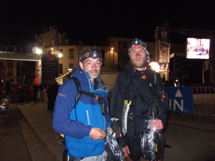
Mission accomplished for Two Chameleons!
Jon (Hardmoors organiser) recognised my Hardmoors Buff and was completely ecstatic to see us there. He immediately called
Mike M., who was really happy to be woken up at 4am and have a chat with us :) . The
full results (PDF) are available online, but some dates are incorrect at the moment (ours in particular).
Showing off finisher jackets after a bit of sleep (not too much apparently).
Split (1): 26:00 hours | 71.5km | +6,079m | -6,690m
Overall (1): 101:30 hours | 238.7km | +17,860m | -17,860m
Post-race
After a bit of sleep on the UTMB camp beds (at least for Leo, I couldn't sleep much for some reason), we managed to find a hotel room surprisingly quickly (maybe because lots of disappointed UTMB runners had left earlier than expected), with a balcony and view on the Mont-Blanc. After a decent lunch, we went to the PTL ceremony, where we got our highly sought after PTL cow bells :)
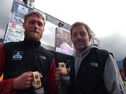
The PTL 2010 cow bell.
With thousands of runners walking around Chamonix with jackets reading "Finisher CCC", "Finisher UTMB" or "Finisher PTL", you could see people trying to get which category you'd belong to. Being PTL finishers definitely dragged a bit more attention.
Timing
I'm rather happy with our timing, summarised here:
| Day | Time | Distance | Ascent | Descent |
|
| km | m | m |
| Wed | 27:00 | 86.1 | +6,186 | -4,725 |
| Rest | 06:00 |
|
|
|
| Thu | 18:30 | 50.6 | +3,050 | -4,160 |
| Rest | 04:30 |
|
|
|
| Fri | 13:30 | 30.6 | +2,528 | -2,285 |
| Rest | 06:00 |
|
|
|
| Sat (1) | 26:00 | 71.5 | +6,079 | -6,690 |
We never felt threatened by the time limit. We spend 85 hours on the move (80 hours removing the 1-hour stops), and 16:30 in main stopovers, of which about 12 to 13 were spend sleeping or trying to.
UTMB/PTL: same weather, different atmosphere...
It's rather interesting to note the difference between the organiser's response to the bad weather and its perception by the runners on the UTMB and on the PTL. The response to the bad weather on the PTL was much more flexible, as there are less runners and they are expected to go through rougher terrain/weather anyway. So it's just a matter of small alterations to the original route on the way. And everyone deals with it. Result: the only happy people on the UTMB forum seem to be the PTL runners.
Given the number of runners on the UTMB, their potential lack of equipment and experience, the organisers couldn't deal with it the same way. They had to stop the race, because even if most runners would go through, statistically something tragic was bound to happen. The UTMB forum is now as active as ever, with debates on whether the race should have been stopped, restarted, the lack of communication, the qualification points, the entry fee, the shuttle bus fee, the photography cost, the finisher jackets, ...
I'm glad I was on the PTL :D
Recovering and moving on
I've only suffered superficial injuries: sunburns, blisters, and scratches. Nothing too serious on the musculotendinous front, neither on the vital organs. I didn't take any medicine either during or after the event, aside from two rehydration sachets (salt and minerals). My right toes still feel a bit numb, though, I hope this is going to get back to normal soon.
A few people mentioned to me there were other similar races out there, like the
Tor des Géants (336km +/-24,000m), that Mark is taking on in about a week.
Nutrition
We've tried to be opportunistic and to make the most of places offering food on the way: refuges, UTMB food stations, restaurants, hotels, tea rooms, ... In total we had prepared 9 pre-packed 5-course mini-meals for each of us: 3 in the bag and 6 to be picked up from the drop bag. Each meal comprised (approx.):
| "Course" | Weight | Energy | E/W ratio |
| g | KCal | KCal/g |
| Mixed cashews and peanuts | 50 | 300 | 6.0 |
| Parmesan + saucisson | 50+50 | 400 | 4.0 |
| Rye and Soreen bread | 50+30 | 200 | 2.5 |
| Chestnut spread | 85 | 210 | 2.5 |
| Snikers | 57 | 270 | 4.7 |
| Total | 372 | 1380 | 3.7 |
Equiment list
Hereafter the equipment we carried along. I'm pretty happy about it, at the obvious exception of the missing suncreen and water disinfection tablets.
| Clothing |
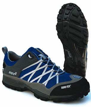
| Shoes | Inov8 Flyroc |
| Pants | M&S (2) |
| Socks | Kalenji run 900 (+ 1 spare) |
| Shorts | Raidlight/Ufo |
| Breathable T-shirt | TNF UTMB 2005 |
| 2 Breathable long-sleeve T-shirts | TNF Flight Series + Icebreaker |
| Long sleeve polar fleece | TNF TKA |
| Waterproof jacket | Millet Gore-Tex |
| Poncho | Forclaz 300 light |
| Long tights | Domyos |
| Sunglasses |
|
| Gloves |
|
| Hat |
|
| Buff | Hardmoors 110 |
| |
| Sleeping |
| Tent | Terra Nova Laser Photon Elite |
| Sleeping bag | Quechua Ultralight S10 |
| |
| Navigation |
| Compass |
|
| Altimeter | in Leo's GPS |
| Pocket knife |
|
| Road-Book | self-printed |
| GPS + track | Garmin GPSmap 60 |
| |
| Other equipment |
| Poles | Leki Makalu Tour |
| Backpack | OMM Classic Marathon 25L |
| Water 1L min | 2L bladder + 1L bottle |
| 2 head torches | Petzl Tikka+ & Petzl Myo XP |
| Spare batteries |
|
| Survival blanket |
|
| Whistle | On bag |
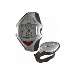
| Watch | Polar RS100 |
| Mobile phone |
|
| First aid kit | Elastoplaste, paracetamol, ibuprofen, Compeeds, Coalgan, plasters |
| Form of ID |
|
| Anti-chaffing | Vaseline + NOK |
| French and British flags on string |
|
| Tissues |
|
| Cash | 150 euros |
| |
| Drop bag |
| Spare water tank |
|
| Clothes: 1 full set + 1 set of underwear |
|
| Spare batteries |
|
| Spare road book |
|
Ultra hike
(1) Reduced a bit by the Mont Rogneux alternative route.
(2) Precision required by Bastien.
