London to Brighton GPS route on GoogleEarth
By Julien on Wednesday, September 5 2007, 18:02 - OFFs - Permalink
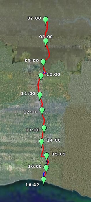
Well, everything is in the title... I've been increasingly asked to use GoogleEarth for my para-academic activities. Just to see how it looks like, I've imported some old GPS track into GoogleEarth. Note that the free version doesn't allow that directly, but a couple of lines of Python can convert very easily any route file into KML. The blue sections were missing and have been drawn by hand. Enjoy.
Click to download the file
Ultra track.
Click to download the file
Ultra track.